
We were already racing daylight when we arrived at the parking lot for the Cape Flattery trail head located on the Makah reservation of Neah Bay, Washington. The northwesternmost point in the contiguous U.S. is a must-see while “up in these parts,” or so the locals said. The trail was a decent side trip from our allotted route, but if there’s one thing I’ve learned while traveling—particularly on a time crunch—it is the value of asking locals where they seek beauty or solace near their hometowns.
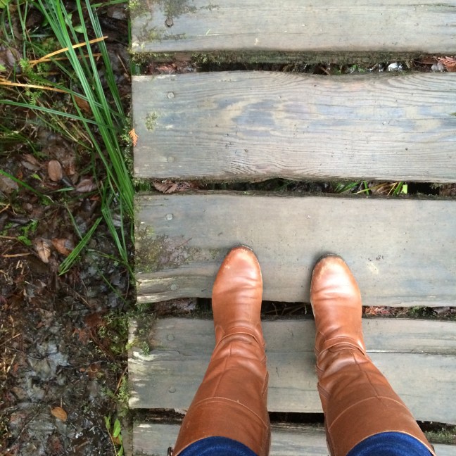
It was approaching magic hour when we parked. The beginning of the trail looked dark enough for us to wonder whether we should begin our trek. There was a brief moment of hesitation, but we decided we hadn’t come this far for nothing. We set off down the wide dirt path in improper shoes—I wearing knee-high brown leather “riding” boots; Mom wearing her old ‘90s snow boots with little remaining tread.
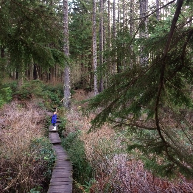
The 1.5 mile round-trip trail is easy breezy and dreamy. Humans dwarf among the large Sitka spruce trees that stand tall as if soldiers guarding the natural habitat surrounding the long stretches of board walk and stepping stumps that usher visitors over deep muddy regions.
It’s an enchanting walk, and one that reminds me that the next trip I take needs to be a slow one with enough time to fully devour an adventure rather than merely experience it. And I’d encourage anyone visiting Cape Flattery to make sure that’s what they do.

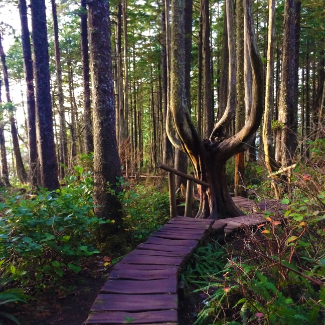
The early sunset light painted the trunk of a pitchfork-shaped tree with gold highlight and navy blue shadow. I could have spent an hour with that tree alone, but the world doesn’t stop spinning for photos, and personal clocks continue to tick. Too fast in this case.
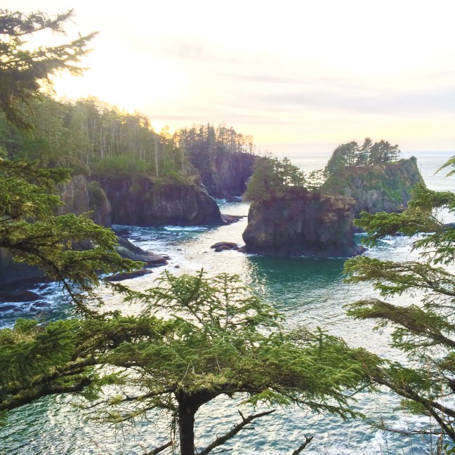
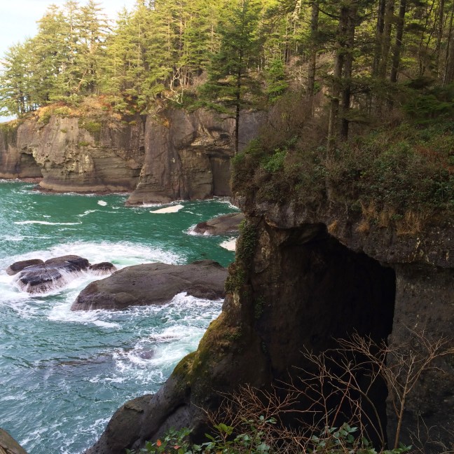
There is a point on the trail that was reminiscent of a wooden ship bow. It looks over sea caves and churning green waters. Maybe it was the pirate-esque environment, but this was a good spot for fight with my Mom who, after about 30 years with me, knows I do dumb things to get good photos.

I’d ventured off the boardwalk and into a muddy path beside it to try to get a shot of the landscape without something man-made in the way. My city boots had little grip and I was caught recovering from an almost slip while continuing to progress toward the rocky cliff’s edge.
Stupid. I’ve decided to save my hiking companions’ vocal cords in the future and get a harness to attach to something sturdy when doing something adventurous. That and hiking shoes.
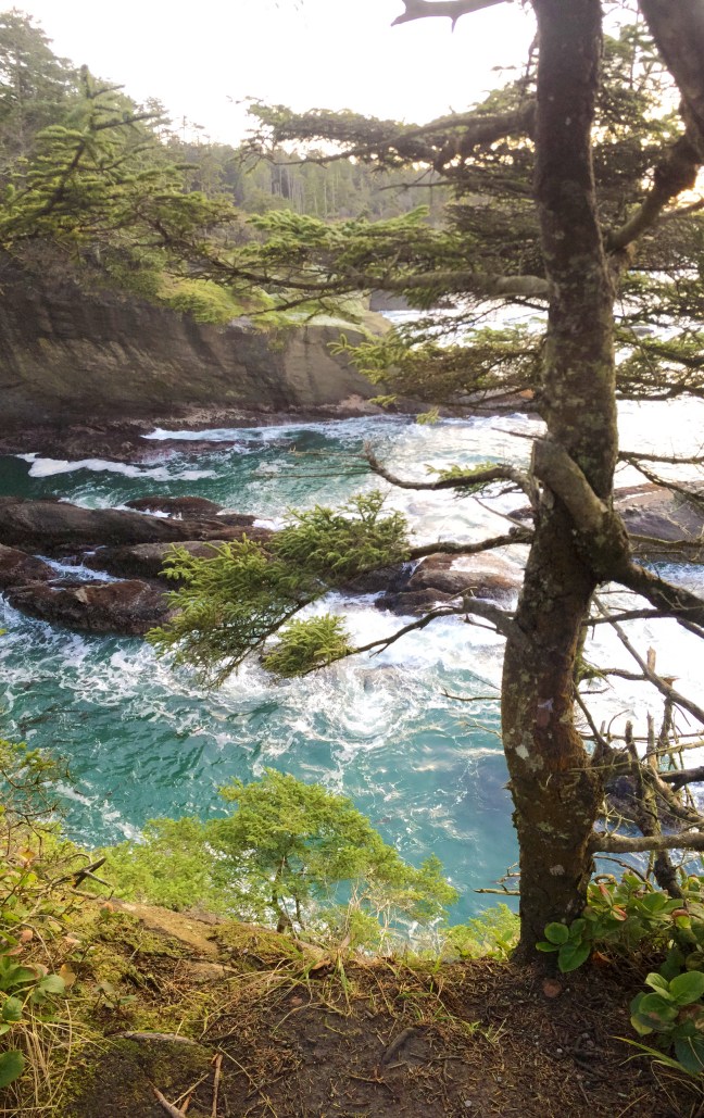
Further down the line we arrived to the viewing platforms that allow for panoramic views of where the Strait of Juan de Fuca meets the Pacific Ocean. It also happens to be where sea otters eat, play and mingle below the cliffs of the Cape Flattery Lighthouse on Tatoosh Island—a sight that had me wishing for a lightweight tripod, a better zoom lens, and above all, a combination of time and patience in making the right photograph.

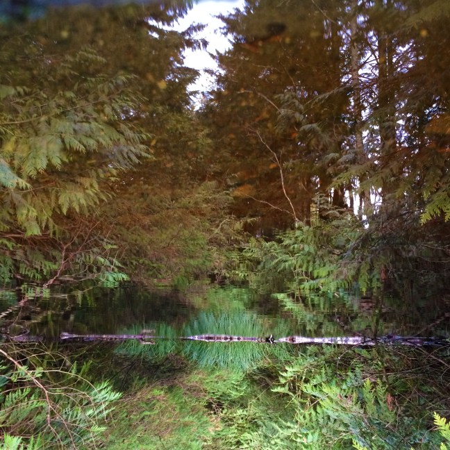
We arrived back to the car just as the warm sunset hues turned to dusky purples and blues. A pond I had missed while rushing to the cape mirrored the trees, moss and other greenery so clearly as if to insist on later being reflected upon among the mental pictures of breathtaking views of the sea.
With no BLM land nearby, we barely made it to a camp outside the Neah Bay reservation before its gates closed in pitch darkness at 7 p.m. I’d have missed a legal or rustic camp space over missing Cape Flattery any day.
